|
||

|

|
|

|
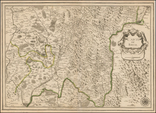
Celebrating The French Revolution
Extremely rare separately published map of France, and environs, published at the end of the 18th Century.
Flanking the detailed cartographic representation are eight vignette views narrating the tumultuous episodes of the French Revolutionary Wars, ranging from the 'Evacuation of Toulon' in 1793 to the climactic Battle of Castiglione in 1796.
The period encapsulated by this map was a significant time of political and territorial reconfiguration in France. Following the Revolution, the newly established government sought to eradicate the vestiges of the Ancien Régime, which included the reorganization of the country into departments instead of the traditional provinces. This cartographic piece provides a visual testament to the country’s revolutionary transformation, as well as the broader European geopolitical landscape affected by France’s expansive military campaigns.
Rarity
The map is extremely rare.
We note an example in the BNF.


![(France under Clovis) Franciae Status sub Regibus Primae Stirpis, ex Observationibus D. Mart. Bouquet Benedictini atque ex Dissertationibus D. Lebeuf Canonici Autis . . . [The State of France under its First Kings. . .]](https://storage.googleapis.com/raremaps/img/small/89714.jpg)