


|
||

|

|
|

|
Detailed tourist and recreational map of Olympic National Park, established in 1938.
The park is a significant conservation area recognized for its ecological diversity, including temperate rainforests, alpine regions, and coastal ecosystems. The map, produced in the mid-20th century, serves as a historical document, reflecting the park's physical and administrative landscape during a period of increased environmental consciousness and park development in the United States. This era was marked by significant governmental efforts to preserve natural beauty and biodiversity, a testament to the evolving ethos of conservation and public enjoyment.
The map’s precision and detail in depicting various natural and human-made features make it an invaluable document for historians and geographers. It delineates park boundaries, trails (distinguished between those for horseback and foot travel), ranger stations, fire lookouts, and public campgrounds, among other features. Such detailed representation offers insights into the park's accessibility, management, and infrastructure at the time, providing a snapshot of the mid-20th-century approach to national park planning and public engagement.
The reverse side of the map contains promotional texts and photographs, aimed at educating the public about the park's unique environments and the importance of conservation. These materials provide context for the map, offering a glimpse into the park's environmental education efforts and the broader movement towards preserving natural spaces for future generations.
The map also provides detailed regulatory guidelines and visitor information, reflecting contemporary policies on park use, wildlife protection, and conservation practices. This section reveals the historical attitudes towards land use, wildlife management, and recreational activities, illustrating how these policies have shaped visitor experiences and park administration.
![[California / Washington / Oregon] Pacific Highway Maps](https://storage.googleapis.com/raremaps/img/small/89058.jpg)
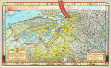
![[Seattle and Vicinity] Seeing Seattle by Water - Anderson Water Tours](https://storage.googleapis.com/raremaps/img/small/77606.jpg)
![[Oregon Territory] Carte de l'Oregon (and) [Astoria Factory]](https://storage.googleapis.com/raremaps/img/small/77722.jpg)

![[ Mt. St. Helens Hazard Analysis Archive - Including Volcanic Ash ] Mount St. Helens Diary: A Sunday Holocaust](https://storage.googleapis.com/raremaps/img/small/72403.jpg)