|
||

|

|
|

|
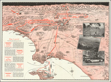
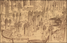
Fine early pictorial map of California, published by the Bank of America, one of a series of maps by the well regarded illustrator Francis De Foy.
The natural, agricultural and manufacturing resources of California are illustrated in this softly colored pictorial map which shows a bird's eye view of California seen from the west, with Crescent City and Cedarville to the left of the map and San Diego and Yuma to the right.
Numerous pictographs show activities, agriculture production, etc.; cities and towns throughout the state are named.
The China Clipper is pictured flying into the Bay Area. The map was published by the Bank of America to promote the Golden Gate International Exposition and encourage tourism in the state. Signature at lower right appears to be Francis de Toy.