|
||

|

|
|

|
Including Early Alaskan Railroads!
The Rand McNally map of Alaska is a detailed illustration of the region, capturing the vast expanses of this northernmost state with a degree of precision that highlights both its natural features and man-made elements.
The map presents an extensive layout of Alaska, marking out towns, mountains, rivers, lakes, and islands with an impressive level of detail. The larger settlements are clearly denoted, and the crisscrossing network of waterways and the outlines of towering mountain ranges lend an understanding of the challenging Alaskan terrain.
Among these features, the map includes specific insets of the Seward Peninsula Mining District and the Mt. McKinley District, two regions of significant historical and economic importance.
The Seward Peninsula, jutting out into the Bering Sea, was the site of a remarkable gold rush at the turn of the 20th century. This was sparked by the discovery of gold in Anvil Creek in 1898, which led to the establishment of the town of Nome. The map details this mining district, capturing a period of vibrant activity and growth.
In contrast, the Mt. McKinley District, encompassing the highest mountain peak in North America, now known as Denali, represents the awe-inspiring natural beauty and diversity of Alaska. Although the district is more known for its wilderness and national park today, in the early 20th century, it was also a site of mining activity, particularly involving copper and lode gold.
Highlighted in red on the map are locations of five early railroads of Alaska. These railroads played an integral part in the economic development of the region. The most prominent among them were the White Pass & Yukon Route, the Copper River & Northwestern Railway, and the Alaska Northern Railroad. The Council City & Solomon River Railroad and Tanana Valley Railroad are also shown.
The White Pass & Yukon Route, built during the Klondike Gold Rush, was primarily used to transport gold from Yukon to the port at Skagway. The Copper River & Northwestern Railway, on the other hand, was constructed to access the rich copper deposits of the Kennecott Mines.
Rand McNally & Co. is a large American map and navigation company best known for its annual atlases. The company got its start in 1856, when William Rand opened a print shop in Chicago. He was joined in 1858 by a new employee, Andrew McNally. Together, the men established their namesake company in 1868. Originally, the company was intended to print the tickets and timetables for the trains running to and through Chicago; their first railway guide was published in 1869.
By 1870, they had shifted from just printing to publishing directories, travel guides, and newspapers. Their first map appeared in 1872 in a railway guide. The map was produced using a new wax engraving method, a cheaper process that gave the company an edge.
By 1880 Rand McNally had entered the education market with globes, wall maps, and geography texts for students. In 1923, Rand McNally published the first Goode’s World Atlas, named after its editor, Dr. J. Paul Goode. For generations afterward, this would be the standard classroom atlas.
In 1899, William Rand left the company, but McNally and his family remained, controlling the company for over a century. In 1904, they published their first road map intended for automobiles and by 1907 were publishing Photo-Auto Guides, which combined photography and mapping to help drivers. In 1924, they produced the Auto Chum, a precursor to their famous road atlases. Rand McNally would remain the leader in road maps and atlases throughout the twentieth century.
In 1937, Rand McNally opened its first store in New York City. Ever on the frontier of technology, Rand McNally pioneered the scribing process for printing tickets in 1958 and printed their first full-color road atlas in 1960. Arthur Robinson developed his now-famous projection of Rand McNally in 1969. By the 1980s, the company was exploring digital reproduction and digital databases of maps for truckers. In the 1990s, they lead the charge to develop trip-planning software and websites. Today, most of its products are available online or in a digital format, including maps for tablets and phones.
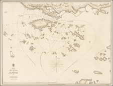
![[ Chinese Voyages To America, etc. ] Memoires De Litterature, Tires Des Registres De L'Academie Royale Des Inscriptions et Belles-Lettres Depuis l' annee M. DCC. XVIII. julques & compris l'annee M. DCC. XXV Tome Quarante-Neuvieme](https://storage.googleapis.com/raremaps/img/small/101296.jpg)

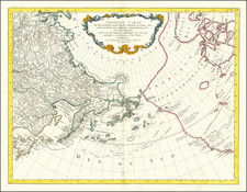
![[ California To Alaska -- Northwest Passage ] Quivirae Regnu cum alijs versus Borea](https://storage.googleapis.com/raremaps/img/small/60083.jpg)