|
||

|

|
|

|
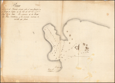
Stock# 100147
Description
This 1958 edition of the "Estados Unidos Mexicanos Mazatlan 13Q-I" map sheet presents a geographical survey from the Comision Intersecretarial Coordinadora del Levantamiento de la Carta Geografica de la Republica Mexicana. Compiled by the Departamento Cartografico Militar, it provides an extensive overview of Mazatlan's topography, infrastructure, and demography, using both aerial and terrestrial surveying techniques.
The map features an array of symbols and notations indicating roads, railways, vegetation types, and water bodies. Population centers are categorized by size, reflecting the demographic distribution of the area.
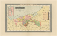
![[Arizona below New Mexico] Mexique d'apres le grand Atlas Dresse Par A.H. Dufour Grave par ch Dyonet Pubie par A. Le Chevalier . . . 1863](https://storage.googleapis.com/raremaps/img/small/64395.jpg)

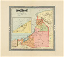
![[Mexico and Central America with Baja California inset, from Generalkarte von Nord America samt den Westindischen Inseln Versasst von Herrn. Pownall . . . MDCCLXXXVIII]](https://storage.googleapis.com/raremaps/img/small/95064.jpg)