|
||

|

|
|

|
Remarkable Sea Chart of the Gulf and Western Caribbean
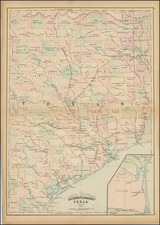
Nice example of Blunt's monumental sea chart of the Southern Coastlines of the United States, from Texas to Florida, along with a highly detailed treatment of Cuba and the Bahamas, first published in 1845, and revised in 1846.
The map provides a remarkably primitive early depiction of the Florida Coastline, pre-dating the results of the Surveys undertaken in the 1850s and 1860s by the United States Coast Survey. The chart includes 10 inset maps and harbor plans, including the harbors of Puerto Rico, St. Thomas, Rum Key, St. Martin's Harbor, Turks Island Anchorage, Havanna, Matanzan, Ragged Islands, Mayaguez, and Tampico.
Originally drawn when Texas was still a Republic. Includes numerous soundings and compass roses.
The present example, revised to 1848, has been significantly improved from the 1846 edition. The middle sheet of this three sheet map has been dramatically updated and improved, with vast revisions in Florida, the Bahamas and Cuba.
The improvements in Florida are not merely coastal in nature. Interior topographical features along the coastlines, extending into the interior in some cases more than 50 miles are present. Roads, forts, woods and many other features have been added, including, for example, references to a number of battles fought during the Seminole Wars, including Clinch's Battle of December 31, 1835 and Gaines' Battle of February 17, 1836. The changes in the major bays on the west coast of Florida are dramatic.
In the southern part of Florida, the Everglades are named and the region has been re-mapped as a large archipelago, with the entirety of the Florida Keys remapped. While somewhat less dramatic, the revisions in the Bahamas and Cuba are significant.
While issued separately, the chart could also be joined with a 3 sheet chart to the south.
Rarity
Blunt's chart is scarce on the market. We have previously had the 1846 edition.
For this significantly revised state, which seems to have first been issued in a 1848, we note an example of this 1848 edition offered by Swann Galleries in 2014 and an example of the 1849 edition offered by Bernard Shapero in 2007. There may also be an 1847 edition, with partial revisions.
OCLC locates several examples dated between 1851 and 1856, but the pre-1850 editions are apparently quite scarce.

![La Florida [with] Guastecan [with] Peruviae Avriferae Regionis Typus](https://storage.googleapis.com/raremaps/img/small/89451.jpg)

![[ Florida / Georgia Coastline ] A Plan of Amelia Harbour and Bar, in East Florida, Surveyed by Jacob Blamey, Master of His Majesty's Schooner St. John](https://storage.googleapis.com/raremaps/img/small/38028.jpg)