- Antique Maps
- South America
- A New and Accurate Map of Paraguay, Rio De La...
This item has been sold, but you can enter your email address to be notified if another example becomes available.
Map Maker
Title
A New and Accurate Map of Paraguay, Rio De La Plata, Tucumania Guaria &c….
Publication Place / Date
London / 1744
Image Dimensions
17 x 14 inches
Color
Uncolored
Condition
VG+
Stock# 0873
SOLD
Map Maker
Authenticity Guarantee
All of our maps are authentic antique maps, printed or drawn on or about the date shown in the description. In rare instances when we offer facsimiles, we will specifically describe the map as a later facsimile and include the date of publication. Certificates of Authenticity are included with each item.
Map Maker
Fast, Global Shipping
Last year we shipped over 4,500 antique maps to more than 50 countries. Maps are shipped Monday through Friday year-round. If an order is received before 2 PM PST, we will ship the order that day. If an order is received after that time, we will ship the next day. We ship maps either flat in custom packages or in specially ordered thick tubes. Shipping rates are provided as part of the checkout process.
Description
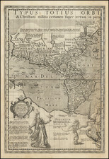
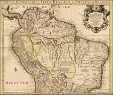
Decorative map of Southern Brazil, Paraguay, Uruguay and parts of Argentina and Chile. Includes a decorative cartouche and compass rose. The map is heavily annotated with notes regarding Indians, rivers mines and other exotic myths.
Emanuel Bowen Biography
Emanuel Bowen (1694?-1767) was a British engraver and print seller. He was most well-known for his atlases and county maps. Although he died in poverty, he was widely acknowledged for his expertise and was appointed as mapmaker to both George II of England and Louis XV of France. His business was carried on by his son, Thomas Bowen. He also trained many apprentices, two of whom became prominent mapmakers, Thomas Kitchin and Thomas Jeffreys.
Related Categories
Related Items