
This item has been sold, but you can enter your email address to be notified if another example becomes available.


|
||

|

|
|

|
Stock# 0002dd
Description
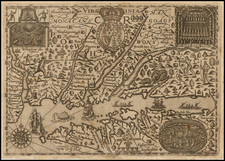
Extremely rare separately issued chart of the eastern part of the United States, from Long Island to Cape Fear, published in New York by Charles Copley.
Includes an extensive table of tides and inset maps showing bays and entrances, including Chesapeake, Cape Fear, New York, Delaware, Hattaras, Ocracoke, Chincotague, and Lookout. Details include lighthouses (shown in red), bays, anchorages, shoals and a host of other fine coastal details.
Copley's chart is extremely rare. We were able to locate only the examples in the British Library.
Condition Description
Flattened and archivally backed. Minor soiling and a tiny bit of loss at upper right corner.
![(Three Days at Gettysburg) Map of the Battlefield of Gettysburg July 1st, 2nd, 3rd 1863. . . [Three Maps]](https://storage.googleapis.com/raremaps/img/small/101769.jpg)

![[ Pictish Warrior Woman ] Feminae Pictae icon V](https://storage.googleapis.com/raremaps/img/small/99648.jpg)
