
Search

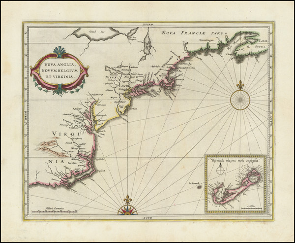
Place/Date:
Amsterdam / 1695 circa
Size:
39 x 32 inches
Condition:
VG
Stock#:
46848
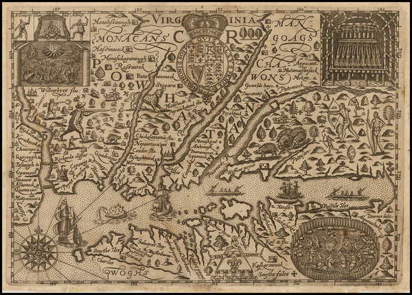
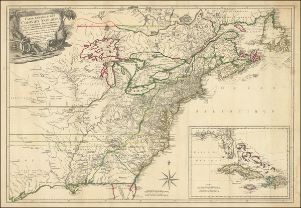
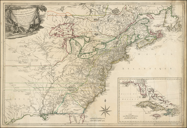
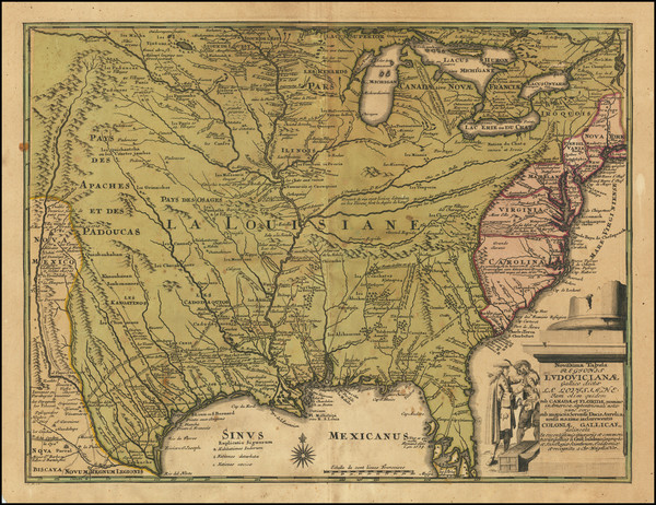
17th Century Dutch Sea Chart on Vellum
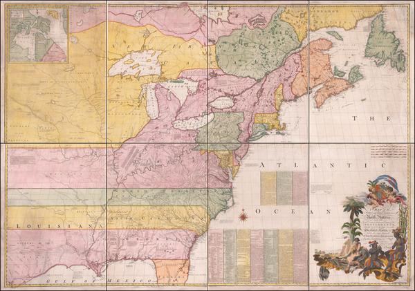
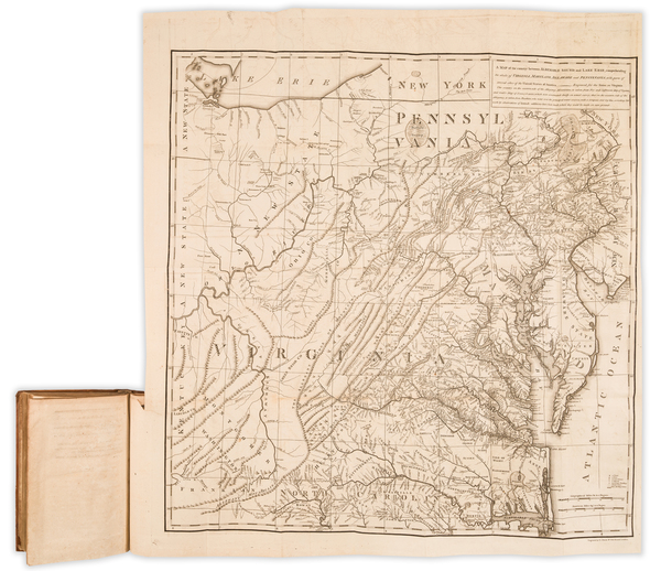
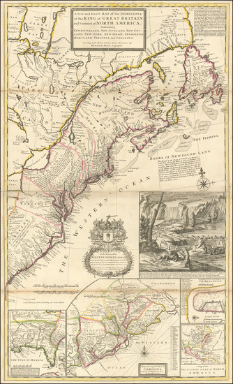
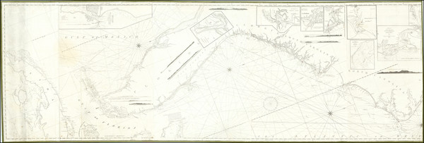
Place/Date:
London / 1755 - 1757
Size:
76 x 53 inches If Joined
Condition:
Good
Stock#:
60574dg
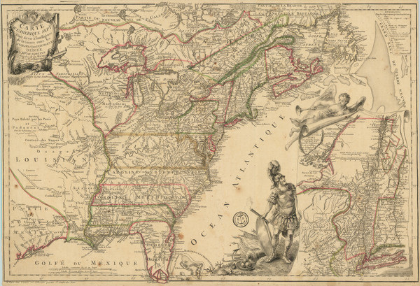
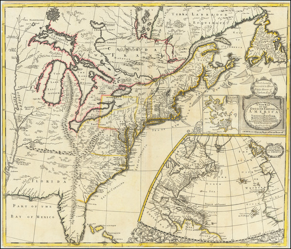
Mitchell's 1755 antique map showing the Mid-Atlantic.
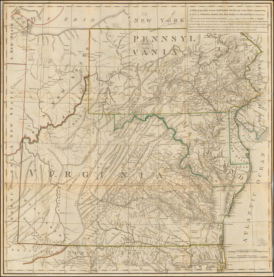
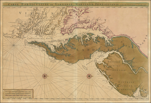
Place/Date:
Frankfurt / 1750
Size:
18 x 23.5 inches
Condition:
VG
Stock#:
51958
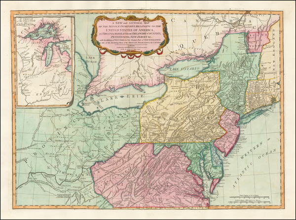
Antique map showing the Mid-Atlantic by Evans made in 1750.
Place/Date:
London / 1685 (1715 ca)
Size:
21.5 x 18 inches
Condition:
VG+
Stock#:
60306op
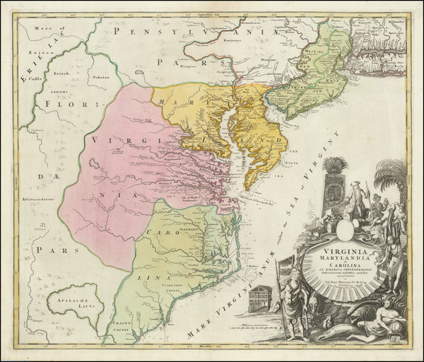
Original map showing the Mid-Atlantic by Morden / Lea / Willdey / Thornton made in 1685.
Place/Date:
Amsterdam / 1778
Size:
12.5 x 12 inches
Condition:
VG+
Stock#:
92476
Place/Date:
Paris / 1786 [1787]
Size:
23 x 23 inches (map size)
Condition:
VG+
Stock#:
51828
Rare map showing the Mid-Atlantic by Jefferson made in 1786.
Place/Date:
Boston / 1794 (1803)
Size:
41 x 33 inches
Condition:
VG
Stock#:
55919ops
Antique map showing the Mid-Atlantic by Norman, 1794.
Place/Date:
London / 1787
Size:
23 x 23 inches (Map)
Condition:
VG
Stock#:
55181
Thomas Jefferson's Map / Book on Virginia
Place/Date:
Paris / 1756
Size:
13.5 x 11 inches ( Whole Sheet)
Condition:
VG
Stock#:
52293op
Gautier d'Agoty's 1756 antique map showing the Mid-Atlantic.
Hall's 1636 antique map showing the Mid-Atlantic.
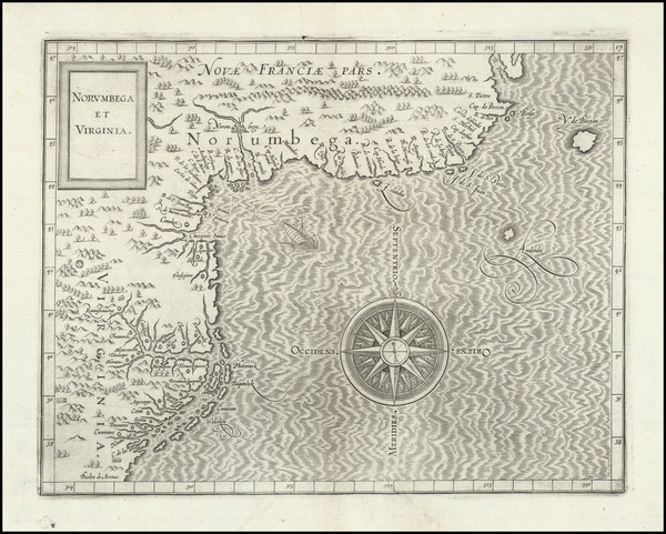
Place/Date:
Paris / 1670 circa
Size:
21.5 x 14 inches
Condition:
VG+
Stock#:
67805
155
Place/Date:
Paris / 1778
Size:
20.5 x 27.5 inches
Condition:
Good
Stock#:
86775
Place/Date:
Paris / 1777
Size:
24.5 x 17 inches
Condition:
VG
Stock#:
95721
Place/Date:
London / 1733
Size:
24.5 x 40.5 inches
Condition:
VG+
Stock#:
101277
Place/Date:
Amsterdam / 1680 circa
Size:
21 x 18.25 inches
Condition:
VG
Stock#:
91239
Place/Date:
Amsterdam / 1666
Size:
21 x 17 inches
Condition:
VG
Stock#:
66883op

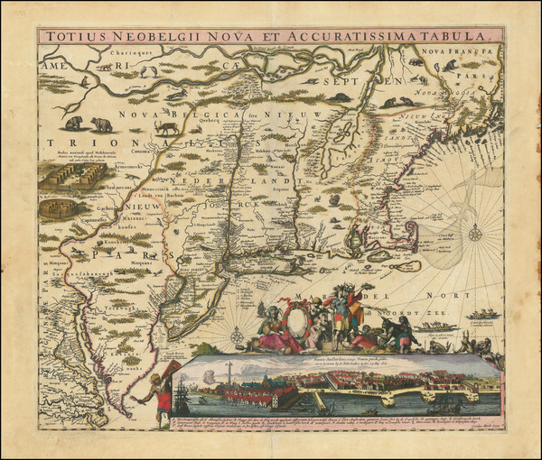
Place/Date:
Amsterdam / 1651 (1660 ca)
Size:
20.5 x 17.5 inches
Condition:
VG
Stock#:
66922
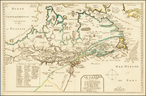
Jansson's 1651 antique map showing the Mid-Atlantic.
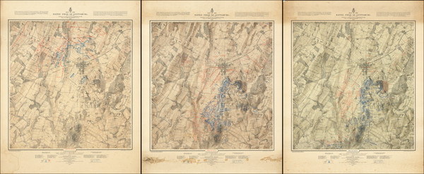
Place/Date:
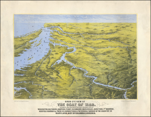
Washington / 1876
Size:
27.5 x 34 inches each
Condition:
VG
Stock#:
101769
Place/Date:
Paris / 1778
Size:
30 x 20.5 inches
Condition:
VG
Stock#:
103467
Place/Date:
London / 1777 circa
Size:
46 x 31.5 inches
Condition:
VG
Stock#:
51531
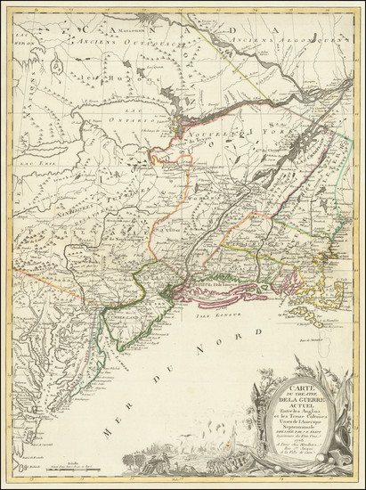
Des Barres's 1777 rare map showing the Mid-Atlantic.
Place/Date:
Paris / 1777
Size:
31.5 x 20.5 inches
Condition:
VG
Stock#:
103484

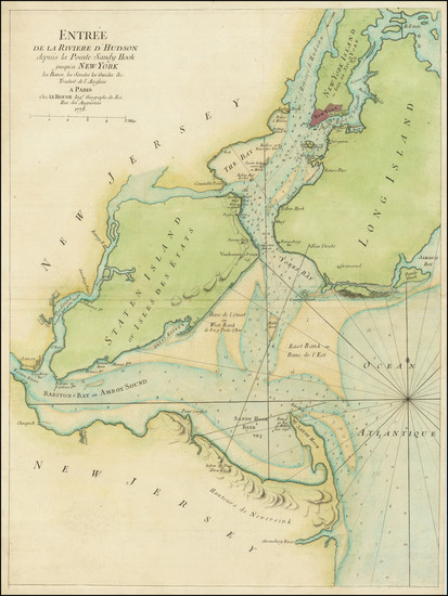
Place/Date:
New York / 1779
Size:
35 x 31 inches
Condition:
VG
Stock#:
51318
Antique map showing the Mid-Atlantic by Des Barres, 1779.
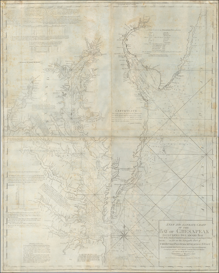
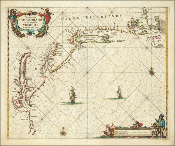
Place/Date:
Amsterdam / 1692
Size:
31.5 x 21.5 inches
Condition:
VG
Stock#:
61392mp2
17th Century Sea Chart of The Chesapeake and Delaware Bay -- Virginia, Maryland, Delaware, New Jersey
Place/Date:
Antwerp / 1625
Size:
14 x 11 inches
Condition:
VG+
Stock#:
91528
Place/Date:
New York / 1825 circa
Size:
86 x 29 inches
Condition:
VG
Stock#:
77294

Place/Date:
Amsterdam / 1684 circa
Size:
21.5 x 18.5 inches
Condition:
VG
Stock#:
93874
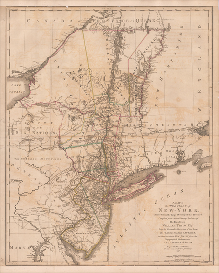
Place/Date:
London / 1776
Size:
22.5 x 28.5 inches
Condition:
Good
Stock#:
60351
Original map showing the Mid-Atlantic by Sauthier / Ratzer, 1776.
Place/Date:
Louvain / 1597 (1607)
Size:
11.5 x 9 inches
Condition:
VG
Stock#:
98918
Place/Date:
Boston / 1861
Size:
16.5 x 19.5 inches
Condition:
VG
Stock#:
102933
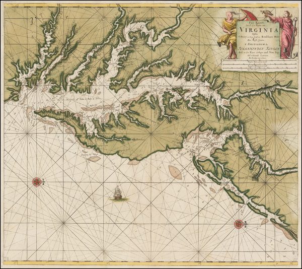
Place/Date:
Amsterdam / 1695 circa
Size:
23 x 20 inches
Condition:
VG
Stock#:
47255
1695 original Van Keulen map showing the Mid-Atlantic.
Place/Date:
Paris / 1778
Size:
20 x 26.5 inches
Condition:
VG
Stock#:
78970
Place/Date:
London / 1776
Size:
20.5 x 43.5 inches Each Sheet
Condition:
Good
Stock#:
91422
Place/Date:
Paris / 1756
Size:
30 x 21.5 inches
Condition:
VG
Stock#:
94026
Place/Date:
Baltimore / 1838 circa
Size:
20.5 x 27 inches
Condition:
VG
Stock#:
45033
Soiecki's 1838 antique map showing the Mid-Atlantic.
Place/Date:
Paris / 1777
Size:
28.5 x 21 inches
Condition:
VG
Stock#:
89535
Place/Date:
Paris / 1753 (1755)
Size:
26.5 x 19 inches
Condition:
VG+
Stock#:
94454
Place/Date:
London / 1719
Size:
22 x 19.5 inches
Condition:
VG
Stock#:
95619
Senex's 1719 antique map showing the Mid-Atlantic.
Place/Date:
New York / 1827 (1840)
Size:
37 x 26.5 inches
Condition:
VG+
Stock#:
84684
Place/Date:
Amsterdam / 1640
Size:
19 x 15 inches
Condition:
VG
Stock#:
93234
Place/Date:
Augsburg / 1757 circa
Size:
22.5 x 19.5 inches
Condition:
Good
Stock#:
63924
Original map showing the Mid-Atlantic by Lotter, 1757.
Place/Date:
Amsterdam / 1737
Size:
20.5 x 22 inches
Condition:
Good
Stock#:
64717
Place/Date:
Amsterdam / 1640 circa
Size:
20 x 15.5 inches
Condition:
VG+
Stock#:
91974

Place/Date:
Augsburg / 1777
Size:
22 x 28.5 inches
Condition:
VG
Stock#:
58857
Rare map showing the Mid-Atlantic by Lotter, 1777.
Place/Date:
London / 1796 circa
Size:
25 x 19 inches
Condition:
VG
Stock#:
50850
Antique map showing the Mid-Atlantic by Bowles & Evans made in 1796.
Place/Date:
Philadelphia / 1813
Size:
18 x 16 inches
Condition:
VG
Stock#:
66754
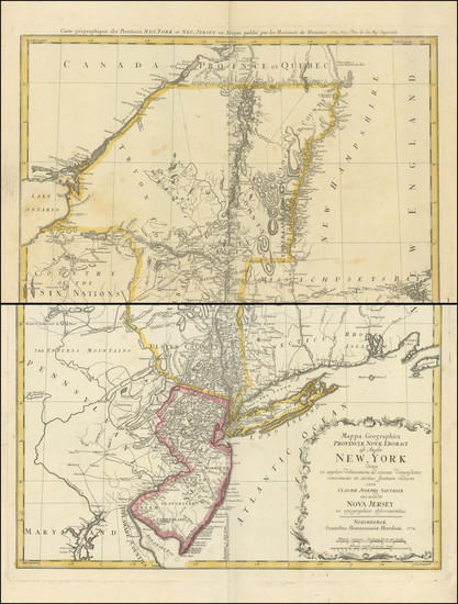
Place/Date:
Nuremberg / 1718
Size:
16.5 x 12.5 inches
Condition:
VG
Stock#:
72622
Place/Date:
London / 1719
Size:
23.5 x 20 inches
Condition:
VG
Stock#:
74465
Rare map showing the Mid-Atlantic by Senex made in 1719.
Place/Date:
Nuremberg / 1720
Size:
23 x 19.5 inches
Condition:
VG
Stock#:
93882
Place/Date:
London / 1794
Size:
26 x 19.5 inches
Condition:
VG
Stock#:
49212
Laurie & Whittle's 1794 original map showing the Mid-Atlantic.
Place/Date:
Nuremberg / 1778
Size:
22 x 28 inches
Condition:
VG
Stock#:
103550