|
||

|

|
|

|
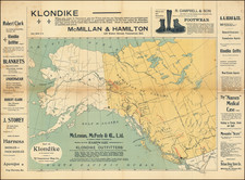
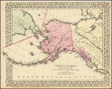
Surveying Routes To The Yukon and Klondike Gold Regions
Finely executed map of the Route From Lynn Canal Via Headwaters of White and Tanana Rivers to Eagle City, prepared from government surveys in aid of finding the best routes to serve miners during the Alaska Gold Rush.
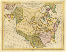
Following the discovery of gold in the Klondike region near Dawson City, Yukon, in 1896, there was a massive influx of prospectors into the region, initiating the famous Klondike Gold Rush that extended into Alaskan territories.
The map outlines a specific route used during this period, starting from Lynn Canal, a key transportation corridor used by gold seekers to access the interior regions. Lynn Canal leads towards the headwaters of the White River, then continues through the rugged terrains to the headwaters of the Tanana River, finally reaching Eagle City. Eagle City, established near the border of Alaska and the Yukon Territory around 1898, became a significant stopover and supply point for miners heading into the Yukon.
his period saw heightened activity in the region, with routes like the Chilkoot and White Pass becoming notoriously difficult due to harsh conditions and overcrowding. The map's route offers insight into alternative paths explored to ease the journey for prospectors and supply chains.