


|
||

|

|
|

|
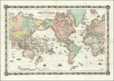
Fascinating world map, oriented with Australia and East Asia at the center of the map, published by Heinrich Scherer.
The map illustrates the major trade routes around the world, including the route of the Manila Galleons in the Pacific Ocean, European trade routes through the Indian Ocean to China and a fascinating northeast passage.
In the four corners, ships bearing the pendants of New England, New Spain, New France and Batavia in the East Indies are shown.
Cartographically, the map is a tour de force of myths and discoveries. California is an Island, Australia's east coast is still undiscovered, New Zealand and Tasmania have not yet been circumnavigated, and the configuration of Japan and lack of any sign of Korea quite fascinating. The remnants of the mythical Compagnie Land is in evidence, with a wide open depiction of both a Northwest Passage and a Northeast Passage.
North Pacific chimeras: Yesso, De Gama, and Compagnie Land
The etymology of the idiom Yesso (Eso, Yeco, Jesso, Yedso) is most likely the Japanese Ezo-chi; a term used for the lands north of the island of Honshu. During the Edō period (1600-1886), it came to represent the ‘foreigners’ on the Kuril and Sakhalin islands. As European traders came into contact with the Japanese in the seventeenth century, the term was transferred onto European maps, where it was often associated with the island of Hokkaido. It varies on maps from a small island to a near-continent sized mass that stretches from Asia to Alaska.
The toponym held interest for Europeans because the island was supposedly tied to mythic riches. Father Francis Xavier (1506-1552), an early Jesuit missionary to Japan and China, related stories that immense silver mines were to be found on a secluded Japanese island; these stories were echoed in Spanish reports. The rumors became so tenacious and tantalizing that Abraham Ortelius included an island of silver north of Japan on his 1589 map of the Pacific.
Yesso is often tied to two other mythical North Pacific lands, Gamaland and Compagnies Land. Juan de Gama, the grandson of Vasco de Gama, was a Portuguese navigator who was accused of illegal trading with the Spanish in the East Indies. Gama fled and sailed from Macau to Japan in the later sixteenth century. He then struck out east, across the Pacific, and supposedly saw lands in the North Pacific. These lands were initially shown as small islands on Portuguese charts, but ballooned into a continent-sized landmass in later representations.
Several voyagers sought out these chimerical islands, including the Dutchmen Matthijs Hendrickszoon Quast in 1639 and Maarten Gerritszoon Vries in 1643. Compagnies Land, often shown along with Staten Land, were islands sighted by Vries on his 1643 voyage. He named the islands for the Dutch States General (Staten Land) and for the Dutch East India Company (VOC) (Compagnies, or Company’s Land). In reality, he had re-discovered two of the Kuril Islands. However, other mapmakers latched onto Compagnies Land in particular, enlarging and merging it with Yesso and/or Gamaland.
In the mid-eighteenth century, Vitus Bering, a Danish explorer in Russian employ, and later James Cook would both check the area and find nothing. La Perouse also sought the huge islands, but found only the Kurils, putting to rest the myth of the continent-sized dream lands.
The popular misconception of California as an island can be found on European maps from the sixteenth through the eighteenth centuries. From its first portrayal on a printed map by Diego Gutiérrez, in 1562, California was shown as part of North America by mapmakers, including Gerardus Mercator and Abraham Ortelius. In the 1620s, however, it began to appear as an island in several sources. While most of these show the equivalent of the modern state of California separated from the continent, others, like a manuscript chart by Joao Teixeira Albernaz I (ca. 1632) now in the collection of the National Library of Brasil shows the entire western half of North Americas as an island.
The myth of California as an island was most likely the result of the travel account of Sebastian Vizcaino, who had been sent north up the shore of California in 1602. A Carmelite friar, Fray Antonio de la Ascensión, accompanied him. Ascension described the land as an island and around 1620 sketched maps to that effect. Normally, this information would have been reviewed and locked in the Spanish repository, the Casa de la Contratación. However, the manuscript maps were intercepted in the Atlantic by the Dutch, who took them to Amsterdam where they began to circulate. Ascensión also published descriptions of the insular geography in Juan Torquemada’s Monarquia Indiana (1613) (with the island details curtailed somewhat) and in his own Relación breve of ca. 1620.
The first known maps to show California as an island were on the title pages of Antonio de Herrera’s Descripción de las Indias Occidentales (1622) and Jacob le Maire's Spieghel Der Australische Navigatie (1622). Two early examples of larger maps are those by Abraham Goos (1624) and another by Henry Briggs, which was included in Samuel Purchas’ Hakluytus Posthumus or Purchas his Pilgrimes (1625). In addition to Briggs and Goos, prominent practitioners like Jan Jansson and Nicolas Sanson adopted the new island and the practice became commonplace. John Speed’s map (1626-7), based on Briggs’ work, is well known for being one of the first to depict an insular California.
The island of California became a fixture on mid- and late-seventeenth century maps. The island suggested possible links to the Northwest Passage, with rivers in the North American interior supposedly connecting to the sea between California and the mainland. Furthermore, Francis Drake had landed in northern California on his circumnavigation (1577-80) and an insular California suggested that Spanish power in the area could be questioned.
Not everyone was convinced, however. Father Eusebio Kino, after extensive travels in what is now California, Arizona, and northern Mexico concluded that the island was actually a peninsula and published a map refuting the claim (Paris, 1705). Another skeptic was Guillaume De L’Isle. In 1700, De L’Isle discussed “whether California is an Island or a part of the continent” with J. D. Cassini; the letter was published in 1715. After reviewing all the literature available to him in Paris, De L’Isle concluded that the evidence supporting an insular California was not trustworthy. He also cited more recent explorations by the Jesuits (including Kino) that disproved the island theory. Later, in his map of 1722 (Carte d’Amerique dressee pour l’usage du Roy), De L’Isle would abandon the island theory entirely.
Despite Kino’s and De L’Isle’s work, California as an island remained common on maps until the mid-eighteenth century. De L’Isle’s son-in-law, Philippe Buache, for example, remained an adherent of the island depiction for some time. Another believer was Herman Moll, who reported that California was unequivocally an island, for he had had sailors in his offices that claimed to have circumnavigated it. In the face of such skepticism, the King of Spain, Ferdinand VII, had to issue a decree in 1747 proclaiming California to be a peninsula connected to North America; the geographic chimera, no matter how appealing, was not to be suffered any longer, although a few final maps were printed with the lingering island.
Charting the outline of Australia, ca. 1800
The outlines of Australia and many toponyms are thanks to the many voyages that charted Australia. The most prominent of these were those of Nicolas Baudin and Matthew Flinders at the turn of the nineteenth century.
When Nicolas Baudin left Le Havre in the Geographe in October 1800, he was embarking on a voyage meant to survey the shores of Australia. He was accompanied by the Naturaliste, commanded by Captain Jacques Felix Emmanuel Hamelin, whose crew included the young naval officer Louis Freycinet. At this time, the British had established their presence in eastern Australia, but the western and southern portions of the continent remained unexplored and not necessarily claimed by the British. In other words, although ostensibly a scientific expedition, the French were also open to possible overseas expansion if the opportunity arose.
Initially the ships, sometimes separated, made their way north up the western coast of Australia from Cape Leeuwin to Timor. They then went south again, but were separated a second time. Baudin and the Geographe made for Van Diemen’s Land and then returned toward the west.
En route, they encountered British naval officer Matthew Flinders in the Investigator. Flinders had initially begun his charting of Australia in the southeast in the mid-1790s, where he surveyed and named the Bass Strait. By the time he met Baudin, Flinders was on his third Australian surveying mission. He was heading to Sydney, from where he would begin a clockwise circumnavigation of the Australian continent, the first such voyage to ever do so.
Baudin and Hamelin were reunited in Sydney, where both ships had come to recuperate in late 1801. During the course of 1802, the Geographe and the Casuarina, a survey vessel purchased by Baudin and commanded by Freycinet, surveyed the southern coast of Australia (the Naturaliste had been sent back to France). They then sailed round the west coast to Timor, then back to Mauritius, where Baudin died. It was also where the Casuarina’s career ended, as the ship was abandoned in favor of consolidating the crews on the Geographe. The ship returned home on March 25, 1804.
Flinders was not so lucky. On his homeward voyage to Britain in late 1803, Flinders was forced to stop in French-controlled Mauritius due to the poor condition of his ship. As Britain and France were then at war, the governor of the island arrested Flinders, detaining him (in relative comfort) for seven years (1803-1810).
Flinders worked on his charts of Australia while in Mauritius, but he was unable to publish them in full. Instead, the first map of the continent was by Freycinet. It appeared in an atlas of the Baudin expedition, released in 1811.
![La Sphere Artificielle . . . 1740 [Terrestrial, Celestial & Armillary Globes]](https://storage.googleapis.com/raremaps/img/small/80300.jpg)
![[World -- Terrestrial Globe Gores]](https://storage.googleapis.com/raremaps/img/small/89195.jpg)
![[World] Generale Ptholemei](https://storage.googleapis.com/raremaps/img/small/94338.jpg)
![[Volcanos and the Subterranean World] Tabula Geographico-Hydrographica Motus Oceani, Currentes, Abyssos, Montes Igniuomos In Universo Orbe Indicans, Notat Haec Fig. Abyssos Montes Vulcanios](https://storage.googleapis.com/raremaps/img/small/95720.jpg)