![[ New York and New Jersey ] Mappa Geographica Provinciae Novae Eboraci ab Anglis New-York… Claudii Josephi Sauthier cui Accedit Nova Jersey ex topgraphicis . . . 1778 By Homann Heirs / Claude Joseph Sauthier](https://storage.googleapis.com/raremaps/img/small/103550.jpg)


|
||

|

|
|

|
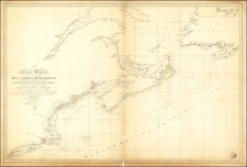
Gorgeous large format map of the region from Montreal to Delaware Bay, centered on New York and the Country of the Six Nations.
Vermont is still a part of New York State. Many counties named. In the western part of the map, there are a number of marvelous ephemeral names, such as the Endless Mountains. South of Lake Ontario on the Cayuuga River and around Oneida Lake, there are over a dozen Indian Villages shown, along with early forts. The map is a faithful reduction of Faden's 6 sheet map. Despite the Latin Title, the nomenclature is entirely in English. The dividing line between East and West Jersey is shown, as are boundaries of Pennsylvania, by Patent and other early boundaries. Many towns and roads are shown. One of the best large format Colonial maps of the region.
Homann Heirs was a German publishing firm that enjoyed a major place in the European map market throughout the eighteenth century. Founded in 1702 by Johann Baptist Homann, the business passed to his son, Christoph, upon Johann’s death in 1724. Christoph died in 1730, aged only 27, and the firm was inherited by subsequent Homann heirs. This altered the name of the company, which was known as Homann Erben, or Homann heirs. The firm continued in business until 1848.