|
||

|

|
|

|
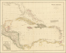
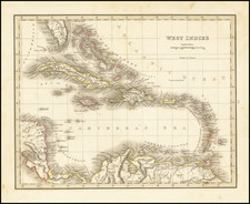
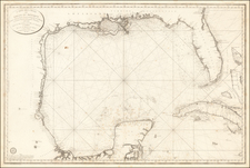
Scarce map of the Caribbean or West Indies, offering a detailed and comprehensive depiction of the Caribbean and the surrounding regions, including the Gulf of Mexico and parts of Central America.
The map spans a vast area, encompassing South Florida, the Gulf of Mexico, the Caribbean islands, and extending into northern South America. It includes detailed renderings of important regions such as the Bahamas (LUCAYOS or BAHAMA ISLES), Cuba, Jamaica, Hispaniola (St. Domingue and Santo Domingo), and the Lesser Antilles. The mainland areas of New Spain (modern-day Mexico), Central America, and the northern coast of South America are also meticulously detailed.
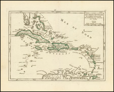
A notable feature of this map is the inset of the "Harbour & Fort of Omoa," located on the northern coast of present-day Honduras. Omoa was a significant Spanish colonial stronghold, known for its impressive fortress, the Fortaleza de San Fernando de Omoa. Built in the mid-1700s, this fortress served to protect against British incursions and secure Spanish trade routes. In 1779, during the Anglo-Spanish War, British forces briefly captured Omoa, highlighting its strategic importance before it was quickly recaptured by the Spanish. The map's inclusion of Omoa underscores its relevance in the geopolitical landscape of the Caribbean during the colonial period.
The map reflects the extensive European exploration and colonization efforts in the Caribbean and Central America. It identifies numerous colonial territories, key ports, and trading hubs, illustrating the economic and strategic significance of the region.
![Cuba Insula [with] Hispaniola Insula [with] Insula Jamaica [with] Ins. S. Ioannis [with] I.S. Margareta Cum Confiniis](https://storage.googleapis.com/raremaps/img/small/95802.jpg)