|
||

|

|
|

|
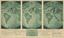
What Germany Wants
This map serves as a compelling visual representation of German imperial ambitions during the First World War, according to the British and French. Published in a period fraught with nationalistic fervor and territorial aspirations, it delineates territories across the globe that were eyed by German thinkers as regions desirable for expansion and control, with those areas of interest boldly marked in red.
At the intersection of geography and ideology, this map provides a profound understanding of the early 20th-century geopolitical landscape when European powers were still engaged in aggressive competition for colonial expansion. It captures the spirit of an era defined by the complex interplay of nationalistic aspirations and the strategic envisioning of a world influenced by German Kultur and power. The map presents a narrative of territorial ambition through the words of influential German figures whose quotations are interwoven with the cartographic content.
Each region highlighted in red on the map is accompanied by a quote from a German thinker, articulating the rationale behind the expansionist desire for that particular area. The map thus offers a window into the pre-war German mindset, characterized by a blend of strategic calculations and ideological motivations for territorial acquisitions spanning from the Americas to Africa and Asia.
However, the map is not only a window into German thought at the time; it was produced in London with a French audience in mind. The unease among the French and British over the possible challenge to their colonial realms is palpable.
Dating the Map
The map mentions Ernst Jäckh in the context of "Deutsche Politik" dated 16 June 1916, which allows us to place its creation at least after this date. Considering the context and content, it can be reasonably estimated that the map was produced during or slightly after 1916, but before the end of World War I in 1918, as it reflects the attitudes and expansionist desires of Germany during the war period.