|
||

|

|
|

|
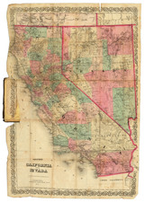
Rare separately published map of Escondido and Rancho Rincon del Diablo, published by San Diego mapmaker, Rodney Stokes in the early 1920s.
The map notes several early subdvisions and shows several of the neighboring ranchos.
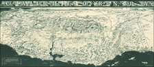
On the verso is a Southern California road map, which includes an early National Highway (Bankhead National Highway), the "Old Spanish Trail" from Miami to San Diego and the "National Old Trails."
The Bankhead National Highway
In the early 20th century, the United States saw a growing need to develop a comprehensive road network. Amid this context emerged the Bankhead National Highway, an initiative aimed at connecting the East and West Coasts. Named after John Hollis Bankhead, a U.S. Senator from Alabama and a significant figure in road infrastructure development, the highway marked a milestone in America's transportation history.
The inception of the Bankhead National Highway can be traced back to the 1910s, during the Good Roads Movement, which emphasized road improvements across the country. The primary goal was to create a transcontinental route starting from Washington, D.C., and terminating in San Diego, California.
Senator Bankhead's contributions to the U.S. road infrastructure were substantial. Serving as the chairman of the Senate Committee on Post Offices and Post Roads, Bankhead was instrumental in the passage of the Federal Aid Road Act of 1916. This legislation marked a significant federal commitment to assist state highway construction efforts. Over the next few years, routes were investigated, roads paved, and existing roads connected, in an effort to piece together a transcontinental route.
In 1919, the Bankhead Highway Association was formed to promote and oversee the development of the highway. This body was essential in lobbying for funds, planning the route, and coordinating with local authorities.
In 1920, the first official route of the Bankhead Highway was delineated. A newspaperman from New Mexico and a good road enthusiast, T.A. Dunn, is thought to have participated in the early exploration efforts for the road throughout the Southwest. In 1921, he authored an early guide, the Authentic Road Map and Motor Tourist Guide of the Bankhead Highway which included illustrated maps of the highway route and information for tourists about the communities it passed through.
Most of the initial construction took place in the 1920s. The focus was on paving and improving existing roads to be included in the highway system. The Bankhead Highway primarily utilized already established roads, so the work involved upgrades rather than building entirely new roads. The Great Depression slowed down many infrastructural projects, but the Bankhead Highway still saw intermittent developments, particularly with the influx of New Deal funds.
The Bankhead Highway traversed various states, namely Virginia, North Carolina, Tennessee, Arkansas, Texas, New Mexico, Arizona, and California. It connected major urban centers, but its impact was also felt in smaller towns and rural communities along its path, which benefited from improved access and subsequent economic opportunities. Key cities on its route included Birmingham, Dallas, El Paso, Phoenix, and Tempe, among others.
Rarity
The present map is rare on the market.
This is the first example we have seen.